1st Seattle Bicycle Disaster Relief Trial Held
June 24, 2013 Some 50 cyclists tested their disaster preparedness skills at the 1st Seattle Disaster Relief Trial. It was held near the University of Washington on June 21st.
2012 was 2nd Most Expensive Disaster Year-- $110 Billion in Damages
June 21, 2013 The U.S. National Climatic Data Center’s (NCDC) announced that according to their 2012 weather and climate disasters information, 2012 saw 11 weather and climate disaster events each with losses exceeding $1 billion in damages. This makes 2012 the second costliest year since 1980, with a total of more than $110 billion in damages throughout the year. The 2012 total damages rank only behind 2005, which incurred $160 billion in damages due in part to four devastating land-falling hurricanes.
107 Tornados have been Recorded over Washington–Some in the Puget Sound Region
June 17, 2013 While Puget Sound rarely sees tornados, they certainly are possible, with 3 tornadoes in the 1960’s alone. www.TornadoHistoryProject.com offers a list of them and can also map them.
Red Cross free Wildfire App joins their First Aid, Hurricane and Earthquake Apps
June 17, 2013 Last October, the American Red Cross released a free Wildfire App for iPhone and Android platforms, which allows users to track blazes this summer.
Washington State Seismic Hazards Catalog
June 14, 2013 If you have even been curious about the potential impact of all those various earthquakes that geologists have identified – and see which might have the largest impact for a general region like Vashon Island (i.e., parcel level damage estimates are NOT supported!), then check out the State Seismic Hazards Catalog.
New Report Confirms Past Cascadia Megaquakes at Barclay Sound’s Effingham Inlet-- Reinforces Prognosis for Upcoming Megathrust Earthquake
June 14, 2013Canadian scientists apply new methods to better understand Pacific coast earthquakes
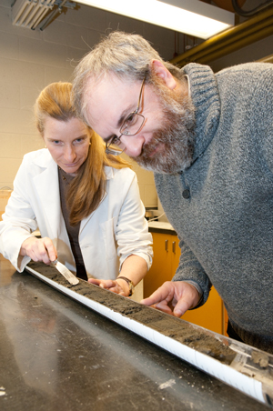
 Understanding the size and frequency of large earthquakes along the Pacific coast of North America is of great importance, not just to scientists, but also to government planners and the general public. The only way to predict the frequency and intensity of the ground motion expected from large and giant "megathrust " earthquakes along Canada's west coast is to analyze the geologic record. A new study published today in the Canadian Journal of Earth Sciences presents an exceptionally well-dated first record of earthquake history along the south coast of BC. Using a new high-resolution age model, a team of scientists meticulously identified and dated the disturbed sedimentary layers in a 40-metre marine sediment core raised from Effingham Inlet. The disturbances appear to have been caused by large and megathrust earthquakes that have occurred over the past 11,000 years.
Open Invitation to Vashon Maury Island Radio Club’s Field Day 2013-- June 22 & 23
June 14, 2013 The Vashon Maury Island Radio Club and VashonBePrepared invites the public to visit Vashon’s amateur radio volunteers at our 2013 Field Day event. Vashon Hams gather at Sunrise Ridge on June 22 & 23 for Field Day’s 80th anniversary to compete in the largest single amateur radio and emergency preparedness exercise, with over 35,000 operators participating throughout the US & Canada.